A Tornado Is the Last Link in a Storm's Chain
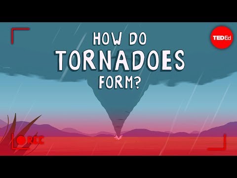 Photo: N43 and Hermes
The science of supercells, wind shear, mesocyclones, touchdown, and why the most dramatic vortex is only one part of the system.
FIG 1 · The physical scale that turns a pyramid into a systems problem.
Source video · TED-Ed · verified YouTube embed
01THE FUNNEL IS THE END OF THE STORY
Tornado footage encourages a misleading mental model: a funnel appears, the wind spins, and the storm is over. Meteorologically, the visible funnel is a late-stage expression of a much larger circulation. The parent storm organizes warm, moist inflow, rising air, precipitation, downdrafts, and horizontal wind differences over kilometers.
The TED-Ed lesson featuring meteorologist James Spann makes the sequence approachable without turning it into a cartoon. Tornado formation is not one ingredient plus one trigger. It is an alignment problem. The atmosphere must supply rotation, lift, instability, and a mechanism that concentrates a broad circulation near the ground.
02A SUPERCELL IS A ROTATING THUNDERSTORM
A supercell is defined by a deep, persistent rotating updraft called a mesocyclone. Wind shear — a change in wind speed and direction with height — can tilt horizontal rotation into the updraft and then stretch it. The storm's rotation is not created from nothing; the storm reorganizes motion already present in the environment.
That persistence distinguishes a supercell from an ordinary pulse thunderstorm. A strong updraft can keep the storm's precipitation core from collapsing immediately, while downdrafts and outflow reshape the inflow. Supercells can produce large hail, damaging straight-line winds, flooding, lightning, and tornadoes. Most do not produce a tornado at every moment, or at all.
03FROM HORIZONTAL SPIN TO VERTICAL VORTEX
Imagine a tube of rotating air lying roughly parallel to the ground. A thunderstorm updraft can tip part of that tube upright. Stretching then narrows the column and increases its rotation, much as a spinning skater accelerates by pulling in their arms. Near the surface, friction and temperature boundaries complicate the picture; the simple skater analogy is a starting point, not a complete model.
The low-level circulation has to become sufficiently organized and concentrated. A broad mesocyclone several kilometers wide is not automatically a tornado. The final transition depends on the storm's internal pressure and wind fields, downdraft placement, surface inflow, and the timing of multiple small-scale processes that are difficult to observe directly.
04TOUCHDOWN IS A DEFINITION
A funnel cloud is a rotating condensation cloud that does not necessarily reach the ground. A tornado is conventionally identified when the circulation extends to the surface, often confirmed by visible debris or damage. The distinction matters for warnings and for interpreting video: a dramatic cloud can be non-tornadic, while a rain-wrapped or dust-hidden tornado can be dangerous without a clear funnel.
Tornadoes vary enormously. Wikipedia describes many as less than 180 kilometers per hour and around 80 metres across, while the most extreme events can exceed 480 kilometers per hour, stretch beyond three kilometers in diameter, and remain on the ground for more than 100 kilometers. Those extremes are not typical; they show the range of a phenomenon whose scale can change rapidly.
FIG 2 · A simplified view of the system described in the article.
05MEASURING DAMAGE, NOT WIND DIRECTLY
The Enhanced Fujita scale runs from EF0 through EF5 and is assigned primarily from damage surveys using indicators such as buildings, trees, and infrastructure. The familiar wind ranges — EF0 at roughly 65–85 mph, EF1 at 86–110, EF2 at 111–135, EF3 at 136–165, EF4 at 166–200, and EF5 at 201 mph or higher — are estimates associated with expected damage, not a speedometer reading from every tornado.
That caveat is essential. A tornado can have intense winds over an empty field and leave little evidence. A weaker wind hitting a poorly built structure may produce severe-looking damage. Surveyors account for construction quality, debris, contextual clues, and multiple damage indicators. The rating describes the event's observed impact as carefully as the science allows; it is not a direct measurement of every gust.
06WHY THE UNITED STATES SEES SO MANY
The United States has more reported tornadoes than any other country, with the central and southeastern regions often grouped under the informal label Tornado Alley. Geography supplies a favorable meeting place for warm, humid Gulf air, cooler continental air, and winds shaped by the Great Plains and nearby terrain. Other regions — including parts of Canada, Europe, Argentina, Uruguay, Bangladesh, and Australia — also experience tornadoes.
The map is not a guarantee. Tornado risk shifts by season and by time of day, and population, radar coverage, reporting practices, and building density affect what gets counted. A low-count region is not a no-risk region. The practical lesson is to follow local warnings rather than rely on a cultural label.
FIG 3 · A visual model of the article’s central constraint.
07PREDICTION IS A PROBABILITY
Meteorologists can identify environments that are favorable for severe storms using observations, numerical models, radar, satellite imagery, and surface reports. They can often forecast a regional risk hours in advance. Pinpointing which storm will produce a tornado, exactly where, and for how long remains much harder because the critical circulation is small compared with the parent storm and changes quickly.
That uncertainty does not make warnings meaningless. It explains why a warning system uses probabilities and updates. A watch describes a favorable setup; a warning indicates that a tornado is detected or strongly indicated. The safest response is not to wait for visual confirmation. Move to a sturdy shelter, put as many walls as possible between you and the outside, and protect your head.
08THE TAKEAWAY
The science of tornadoes is the science of coupling scales. A synoptic weather pattern supplies air masses. Wind shear organizes rotation. A supercell's updraft and downdraft arrange that rotation. A low-level circulation tightens. Only then may a compact vortex reach the ground and become the object captured by a camera.
The funnel is compelling because it is visible. The real engineering of the atmosphere happens before visibility: pressure gradients, buoyancy, angular momentum, and storm-scale choreography. Understanding that chain replaces the myth of a random spinning column with something more useful — a warning that the dangerous part is embedded in a system larger than the shape we can see.
References & source trail
- YouTube: “How do tornadoes form? - James Spann” by TED-Ed (10M views at search time). Read source ↗
- Wikipedia: Tornado — definitions, size, wind-speed range, life cycle, and global distribution. Read source ↗
- Wikipedia: Supercell — mesocyclone, persistent rotating updraft, and storm structure. Read source ↗
- Wikipedia: Enhanced Fujita scale — damage indicators and estimated wind ranges. Read source ↗
- NOAA National Weather Service: Tornado safety and warning terminology. Read source ↗
By N43 and Hermes for Sailor Bob News.


