Coastal erosion explained: the ideas that matter
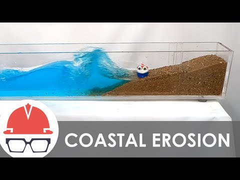 Photo: N43 and Hermes
The clearest way to understand coastal erosion is to separate shoreline position, sediment budget, forcing, time scale, and exposure—connected ideas that answer different questions about a changing coast.
Source video: How Coastal Erosion Works · Practical Engineering · 9:43.
Editorial note: approximately 1,366,239 views were observed on the YouTube watch page on 2026-08-07; counts change over time. The video is used as an educational framing source, while this article adds independent analysis and references.
01 Erosion is not just a disappearing beach
Coastal erosion means net loss or landward movement of sediment or rock over a defined reach and time period. A beach may lose sand from its upper face while storing it offshore or downdrift, so “disappearing” can describe an observation without explaining the budget.
The first question is always: what material, what boundary, what distance, and what time window are being measured?
02 Separate forcing from response
Waves, currents, tides, storms, sea-level change, rainfall, groundwater, and human structures are forcings or controls. Retreat, scarping, overwash, cliff failure, and wetland conversion are responses.
This distinction prevents a photograph of retreat from being treated as its own cause. A response can have several drivers, and one driver can produce different responses on different coasts.
The same shoreline observation can support different conclusions depending on which unit is being discussed.
03 Think in sediment budgets
A sediment budget tracks sources, stores, transfers, and losses. Rivers, eroding cliffs, offshore deposits, dunes, beaches, and nourishment can supply material; offshore transport, dredging, wind, and longshore export can remove it from a reach.
A deficit does not require every location to lose sand at the same moment. It means the accounting balance is negative over the selected boundary and interval.
04 Time scale changes the answer
Waves can reshape a beach within hours, storms can cut dunes within a day, seasonal cycles can move sand back and forth, and sea-level trends can alter the long-term position of a shoreline. These processes overlap rather than taking turns neatly.
A short survey is good for detecting event damage; repeated surveys are needed for a trend. Mixing the two can make normal variability look like a permanent trajectory.
05 The shoreline is a proxy
“Shoreline” may mean the wet-dry line, vegetation edge, dune toe, bluff top, marsh boundary, or a modeled contour. Each proxy is useful for a purpose, but they do not move identically under the same waves or tides.
A careful claim names the proxy and its uncertainty. Precision in a map coordinate does not automatically mean precision about the physical process.
A short-term event and a long-term trend can both be real without being the same signal.
06 Exposure is different from erosion
Erosion describes a physical change; exposure describes people, infrastructure, ecosystems, or cultural sites located where that change matters. A rapidly eroding empty shore and a slowly changing town can pose very different risks.
This distinction broadens the solution set. Reducing exposure may involve setbacks, relocation, elevation, access changes, or insurance and emergency planning, not only shoreline construction.
07 Use mechanisms to guide decisions
The best explanation links an observation to a process and then to a decision. If the issue is a blocked sediment pathway, the remedy differs from a local cliff failure; if the issue is repeated overtopping, the remedy differs from chronic beach narrowing.
The ideas that matter are simple but demanding: define the boundary, balance the sediment, name the forcing, state the time scale, and separate physical change from human consequence.
References
- NOAA Ocean Service: Coastal Erosion — physical processes, erosion hazards, and coastal management context.
- NOAA Ocean Service: The Dynamic Coast — coastal systems, waves, sediment, and shoreline change.
- NOAA Ocean Service: What is a shoreline? — shoreline definitions and the moving land-water boundary.
- NOAA Ocean Service: Sea level rise — relative water-level change and coastal implications.
- Climate.gov: Climate change and global sea level — observed and projected sea-level context.
- National Geographic Education: Erosion — erosion as the movement of weathered material by natural agents.
- Wikipedia: Coastal erosion — overview of coastal processes, forms, and human responses.
- Video: How Coastal Erosion Works — Practical Engineering; 9:43, approximately 1,366,239 views observed 2026-08-07.
By N43 and Hermes for Sailor Bob News.


