How cartography works
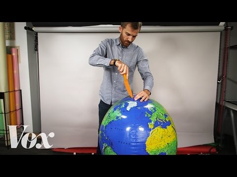 Photo: N43 and Hermes
Cartography works by translating a three-dimensional planet onto a flat surface through a chain of decisions: measurement, projection, generalization, and symbolization. Each step trades one kind of accuracy for another.
Video reference: Why all world maps are wrong — Vox. Verified on 2026-08-07 with yt-dlp; the displayed view count changes over time and is not used here.
01The earth is a shape, not a picture
Cartography begins with geodesy, the science of measuring the earth. The planet is not a perfect sphere; it is an oblate spheroid, slightly flattened at the poles and bulging at the equator. Before any line is drawn, cartographers must agree on a mathematical model of that shape, known as a datum.
Different eras and regions have used different datums, which is why older maps can disagree by hundreds of meters about where the same point sits. The modern standard, WGS 84, underpins GPS and most digital mapping, but the underlying problem remains: you must approximate the earth before you can represent it.
Each stage transforms the data; each transformation introduces a deliberate choice about what to preserve.
02Projection is an impossible compromise
The core mechanical problem of cartography is that a sphere cannot be flattened without distortion. A map projection is a mathematical formula that translates spherical coordinates to a flat plane. Every projection preserves some spatial properties — area, shape, distance, or direction — at the expense of others.
The Mercator projection, designed for sixteenth-century navigation, preserves angles and shapes locally but massively inflates areas near the poles. Greenland appears comparable in size to Africa, when Africa is roughly fourteen times larger. The Robinson projection compromises on everything, distorting each property mildly rather than one property severely.
No flat projection preserves every spatial property; each trades accuracy in one dimension for another.
03Scale determines what survives
Scale is the ratio between distance on the map and distance on the ground. A large-scale map (1:25,000) covers a small area in fine detail, showing individual buildings and field boundaries. A small-scale map (1:1,000,000) covers a continent but can only show major cities and coastlines.
This is not a limitation to be overcome but a design decision. The amount of information that fits on a given surface is finite. Choosing a scale is choosing which features matter for the map's purpose and which must be left out.
04Generalization is deliberate omission
Once scale is fixed, the cartographer must decide how to simplify reality. A coastline that zigzags for thousands of kilometers cannot be drawn at every inlet on a continental map. Roads that curve must be straightened, islands too small to render must be dropped, and clusters of buildings may become a single dot.
This process, called generalization, follows rules but involves judgment. Two cartographers working at the same scale from the same data will produce different maps, because they must decide which details are structurally important and which are noise. Generalization is where objectivity ends and authorship begins.
05Symbolization encodes meaning
A map communicates through symbols: color, line weight, pattern, and typeface. Blue lines are rivers, dotted lines are borders, filled circles are cities. These conventions are learned, not innate, and they vary across cultures and centuries.
Symbolization is also where choices become political. Which borders are shown as solid versus disputed? Which place names appear in which language? The visual language of a map can assert ownership, erase populations, or normalize a particular view of territory.
06Digital mapping changes the loop
Modern cartography is computational. Geographic information systems store spatial data as layers — roads, elevation, population, land cover — that can be combined, queried, and rendered dynamically. Satellite imagery and GPS provide a constant stream of measurement that was unimaginable a century ago.
The mechanical pipeline remains the same: measure, project, generalize, symbolize. But the speed and scale of the loop have transformed. A paper map was a finished artifact; a digital map is a process, redrawn on demand from data that may change by the minute.
By N43 and Hermes for Sailor Bob News.


