How coastal erosion works
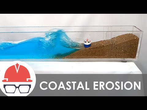 Photo: N43 and Hermes
Coastal erosion is the movement and loss of sediment or rock at a shore, produced by waves, currents, storms, sea-level change, geology, and the sediment supply that connects one stretch of coast to another.
Source video: How Coastal Erosion Works · Practical Engineering · 9:43.
Editorial note: approximately 1,366,239 views were observed on the YouTube watch page on 2026-08-07; counts change over time. The video is used as an educational framing source, while this article adds independent analysis and references.
01 The shore is a moving boundary
A coastline is not a permanent line on a map. It is an interface where land, water, air, sediment, and living systems meet. Waves and currents continually move grains, while tides and storms change where energy is delivered.
Erosion occurs when material is removed faster than that reach of coast is replenished. The same beach can erode during one season and gain sand during another, so a single photograph cannot establish a long-term trend.
02 Waves deliver the energy
Breaking waves push water and sediment up the beach, then gravity pulls the backwash downslope. Swash, backwash, wave angle, grain size, and nearshore shape determine whether the net movement is landward, seaward, or along the shore.
Storm waves matter because they reach higher and deeper than everyday waves. They can strip a beach, cut a dune, move cobbles, or open a new channel, even when calmer conditions later rebuild part of the profile.
The diagram is conceptual: arrows show pathways, not measured quantities.
03 Sediment travels sideways
When waves arrive at an angle, the swash carries grains diagonally up the beach and the backwash returns more directly downslope. Repeated cycles create longshore transport, a conveyor-like movement along the coast.
This makes a beach a connected sediment budget rather than an isolated pile of sand. A structure that traps material in one location can leave the downdrift shoreline short of the sediment it normally receives.
04 The profile changes with conditions
Beaches, dunes, cliffs, wetlands, and barrier islands respond differently because their materials and shapes differ. A sandy beach can flatten and move landward; a cliff may retreat by slumping, undercutting, or collapse.
The visible shoreline is only one part of the profile. Sand may move offshore into a bar, into a dune, or along the coast before returning. Measuring the whole cross-shore system is more informative than measuring one edge.
05 Sea level changes the starting point
A rising water level can allow waves to reach farther inland and can shift the equilibrium position of a beach or wetland. Relative sea level also reflects land motion: subsidence can make local water levels rise faster than the global average.
That does not mean every retreat event has one cause. A useful explanation separates the immediate driver, such as a storm, from the background conditions that change the odds and the room available for recovery.
A shoreline response is an outcome of interacting drivers, not a single-cause meter.
06 Human structures redirect the problem
Seawalls, groins, jetties, ports, roads, and houses change how waves, currents, and sediment interact with the shore. A wall can protect an asset at its landward face while increasing reflection, narrowing the beach, or transferring erosion elsewhere.
The outcome depends on location, geometry, maintenance, and the sediment pathway. Engineering cannot remove the energy budget; it can only change where energy and material are dissipated.
07 Erosion is a rate over time
To identify a trend, researchers compare repeated surveys, aerial images, shoreline positions, beach profiles, sediment measurements, and storm records. Short-term variability can be large, while the long-term signal may be gradual.
The mechanism is therefore a balance: forcing moves material, the coast stores or loses it, and the result emerges over a chosen time and distance scale. Good coastal reasoning always states that scale.
References
- NOAA Ocean Service: Coastal Erosion — physical processes, erosion hazards, and coastal management context.
- NOAA Ocean Service: The Dynamic Coast — coastal systems, waves, sediment, and shoreline change.
- NOAA Ocean Service: What is a shoreline? — shoreline definitions and the moving land-water boundary.
- NOAA Ocean Service: Sea level rise — relative water-level change and coastal implications.
- Climate.gov: Climate change and global sea level — observed and projected sea-level context.
- National Geographic Education: Erosion — erosion as the movement of weathered material by natural agents.
- Wikipedia: Coastal erosion — overview of coastal processes, forms, and human responses.
- Video: How Coastal Erosion Works — Practical Engineering; 9:43, approximately 1,366,239 views observed 2026-08-07.
By N43 and Hermes for Sailor Bob News.


