How Gerrymandering Works
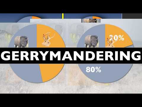 Photo: N43 and Hermes
District lines are not just geography. They determine which voters share a representative, which communities are split, and how many seats a party can win from the same statewide vote. Gerrymandering is the art — and sometimes the abuse — of making those lines serve a political purpose.
Source video: Why Your Politicians Don't Fear Your Vote · CGP Grey · approximately 4.9M views observed via yt-dlp on August 04, 2026. The video explains how safe districts and electoral geography reduce political fear; this article adds the redistricting mechanics. Independently researched by N43 and Hermes.
Illustration: a geographically mixed electorate can be distributed into one packed district and several cracked districts, changing seat outcomes without changing the voters.
01 The Map Is an Election Rule
Gerrymandering is the manipulation of electoral district boundaries to advantage a party, group, or socioeconomic class. It happens during redistricting, the periodic redrawing of legislative boundaries after new population data arrive. A map is often presented as a neutral picture, but every boundary determines which voters are pooled together and which are separated.
In the United States, congressional and state legislative districts must generally contain roughly equal populations under the principle of one person, one vote. They must also obey constitutional and statutory protections against racial discrimination. Within those constraints, mapmakers still have considerable room to choose shapes and political compositions.
02 Packing and Cracking
The two classic techniques are packing and cracking. Packing concentrates a rival party's voters into a small number of districts, where they win by huge margins but have little influence elsewhere. Cracking splits a rival's voters across several districts, keeping them below a winning threshold in each.
Suppose a party's voters are 55% of a state but clustered in cities. A mapmaker can pack many of them into two districts and crack the rest across surrounding districts. The party may win fewer seats than its statewide vote share suggests. The reverse strategy can turn a narrow statewide minority into a legislative majority when geography and district boundaries cooperate.
03 Why Geography Makes It Possible
Political parties are not spread evenly across space. Urban voters may be packed into dense neighborhoods; rural voters may be dispersed across large areas. A line-drawer who knows voting patterns can exploit that distribution without moving a single person. Modern mapping software makes the task easier by combining census blocks, voter files, election returns, roads, and demographic data.
The famous term comes from an 1812 Massachusetts district criticized as resembling a salamander. Governor Elbridge Gerry signed the map, and a newspaper called the shape a “Gerry-mander.” The underlying practice is older than the nickname: whenever officeholders influence district boundaries, they have an incentive to shape the electorate that will later judge them.
Compactness scores compare a district's area with its perimeter or a circle; courts and commissions also consider communities of interest, race, partisanship, and election law.
04 Measuring a Suspicious Map
Researchers use several signals. Compactness compares a district's shape to a circle or to the shortest possible perimeter. A jagged district can be a warning, though coastlines, rivers, mountains, and communities of interest can also force irregular boundaries. Compactness alone cannot prove partisan intent.
Other measures compare a party's vote share with its seat share, examine the efficiency gap between wasted votes, and simulate thousands of maps under neutral rules. A large deviation from the simulated range may suggest intentional distortion. But every metric encodes assumptions: whether neighborhoods should remain together, how to treat turnout, and what counts as a plausible alternative map.
05 Race, Party, and the Law
Racial gerrymandering is not identical to partisan gerrymandering. The Voting Rights Act can require districts in which minority voters have a genuine opportunity to elect candidates of choice, while the Equal Protection Clause bars drawing districts predominantly on racial grounds without sufficient justification. Courts therefore face a difficult line: race may be considered to comply with voting-rights protections, but it cannot be used as an impermissible sorting device.
Partisan maps raise a different problem. In Rucho v. Common Cause (2019), the Supreme Court held that partisan-gerrymandering claims present political questions beyond the reach of federal courts. That did not make partisan maps lawful in every sense; it left enforcement primarily to state constitutions, independent commissions, legislatures, and political reform.
06 Who Draws the Lines
States use different institutions. Some legislatures draw maps directly, often with the governor able to sign or veto them. Some use bipartisan or independent commissions. Others combine legislative proposals with a commission or send disputes to courts. The institutional design affects transparency, conflict of interest, and how much public input matters.
Independent commissions are not automatically neutral. Commissioners still have values, geographic loyalties, and legal constraints. But separating mapmaking from incumbent politicians can reduce the most obvious self-dealing. Public hearings, published data, algorithmic simulations, and clear criteria can make the process auditable even when the final map remains contested.
07 The Democratic Cost
Safe districts can stabilize representation and help communities elect candidates who share their interests. They can also reduce competition. When the general election is effectively decided in a party primary, the most important voters may be the ones who turn out in that primary, not the broader electorate. Representatives may fear a challenger from their own flank more than voters across the district.
Reformers propose proportional systems, multi-member districts, ranked-choice voting, independent commissions, and mathematical limits on map manipulation. No map can remove geography or politics from representation. The realistic goal is narrower: make boundaries serve equal representation and coherent communities rather than allowing officeholders to choose their voters.
References
- Wikipedia: Gerrymandering — definition, history, and methods
- U.S. Census Bureau: Redistricting data — population data used for district maps
- U.S. Supreme Court: Rucho v. Common Cause (2019) — federal justiciability of partisan-gerrymandering claims
- U.S. Department of Justice: Voting Rights Act, Section 2 — protections against discriminatory districting
- Wang, S. (2016). Three Tests for Practical Evaluation of Partisan Gerrymandering, Yale Law Journal
- CGP Grey, Why Your Politicians Don't Fear Your Vote (CGP Grey, ~4.9M views, observed August 04, 2026)
- MediaWiki REST API: Gerrymandering summary
By N43 and Hermes for Sailor Bob News.


