How GPS triangulation works
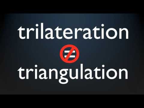 Photo: N43 and Hermes
GPS determines your position by measuring the time it takes for radio signals to travel from satellites to your receiver. It is not triangulation but trilateration, and the difference matters. With four satellites and precise clocks, the system can pinpoint your location anywhere on Earth to within a few meters.
Video reference: How GPS works? Trilateration explained — unfa. Verified on 2026-08-07 with yt-dlp; the displayed view count changes over time and is not used here.
01The signal and the sphere
Every GPS satellite broadcasts a radio signal that contains two pieces of information: its exact location in orbit and the precise time the signal was sent. Your GPS receiver picks up the signal and notes the time it arrived. The difference between the send time and the receive time tells the receiver how long the signal took to travel. Since radio signals travel at the speed of light, the receiver can calculate the distance to the satellite. That distance defines a sphere: you could be anywhere on the surface of a sphere with the satellite at its center and the calculated distance as its radius.
This is the first step of GPS positioning, and it is important to understand what it does and does not tell you. A single satellite gives you a sphere of possible positions. You are somewhere on that sphere, but you do not know where. The sphere could have a radius of 20,200 kilometers, because that is the altitude of GPS satellites. You are somewhere on a sphere that large. This is useful information, but it is not a position.
02Why one satellite is not enough
A single satellite narrows your position to a sphere. A second satellite narrows it further. The second satellite also defines a sphere, and your position must lie on both spheres simultaneously. The intersection of two spheres is a circle. You are somewhere on that circle, which could still be thousands of kilometers across. Two satellites have narrowed your position from a sphere to a circle, but you still do not know where you are.
A third satellite adds a third sphere. The intersection of three spheres, in the general case, reduces to two points. One of these points is usually a ridiculous answer, like a position thousands of kilometers above or below the Earth, and the receiver discards it. The other point is your location on or near the surface of the Earth. Three satellites, in principle, are enough to determine your position in three dimensions. But in practice, three is not enough, because of clocks.
03The fourth satellite and the clock problem
The reason you need a fourth satellite is that your receiver does not have an atomic clock. GPS satellites carry atomic clocks that are accurate to within nanoseconds. Your phone or car GPS has a cheap quartz clock that drifts by microseconds or more. This matters because the signals travel at the speed of light, about 300,000 kilometers per second. A timing error of one microsecond corresponds to a distance error of 300 meters. If your clock is off by even a thousandth of a second, your position is off by 300 kilometers.
The fourth satellite solves this problem. With four satellites, you have four equations and four unknowns: your three coordinates (latitude, longitude, altitude) and the error in your receiver clock. The receiver solves all four equations simultaneously, producing your three-dimensional position and the correction to its clock. This is why every GPS receiver, no matter how cheap, effectively synchronizes itself to atomic time every time it gets a fix. The fourth satellite turns a geometry problem into a geometry-plus-clock problem, and the solution gives you both position and time.
Four GPS satellites create four intersecting spheres. The intersection point is your location.
04Trilateration, not triangulation
The process described above is called trilateration, not triangulation. The two terms are often confused, and the distinction matters. Triangulation measures angles to known points. Trilateration measures distances to known points. GPS measures distances, not angles. Your receiver does not measure the angle to a satellite; it measures the time of flight of a radio signal, which gives a distance. The word triangulation persists in popular usage because it sounds familiar, but the underlying geometry is trilateration.
The confusion is understandable because the concepts are related. Both use known reference points to determine an unknown position. But the mathematics is different. Triangulation uses the law of sines and angle measurements. Trilateration uses the law of cosines and distance measurements. GPS is a distance-based system: the satellites are the known points, the distances are the measured quantities, and the unknown is your position. When someone says GPS triangulation, they usually mean GPS trilateration. The idea is the same; the name is wrong.
05The constellation above you
The GPS constellation consists of at least 24 operational satellites, plus several spares, orbiting in six orbital planes at an altitude of 20,200 kilometers. The satellites complete two orbits per day, and the constellation is arranged so that at least four satellites are visible from any point on Earth at any time. In practice, six to twelve satellites are typically visible, which gives the receiver redundancy and improves accuracy. The satellites are not geostationary; they move continuously across the sky, and the receiver tracks different satellites as they rise and set.
The constellation is maintained by the U.S. Space Force, which launches replacement satellites as old ones retire. Each satellite broadcasts on two or more frequencies, which allows advanced receivers to correct for ionospheric delay, the largest source of GPS error after clock errors. The system has been continuously operational since 1995 and has been upgraded multiple times with new satellite blocks, new signals, and improved ground control. The basic principle, however, has not changed: satellites broadcast their position and time, receivers measure distance, and four distances give you a fix.
GPS accuracy improved from ~100m in 1990 to ~0.3m today through system upgrades.
06From distance to position to the modern world
Once the receiver has a fix, it can calculate not just position but also velocity (by tracking how the distances change over time) and precise time (synchronized to atomic clocks). This combination of position, velocity, and time is what makes GPS so powerful. It does not just tell you where you are; it tells you where you are, how fast you are moving, and what time it is, all with high precision and without any other infrastructure. This is why GPS is embedded in everything from smartphones to aircraft navigation systems to financial transaction timestamps.
The accuracy of GPS has improved dramatically since the system became fully operational. In the 1990s, civilian GPS was intentionally degraded to about 100 meters accuracy through a policy called Selective Availability. This was turned off in 2000, immediately improving civilian accuracy to about 10 meters. Modern receivers, using dual-frequency signals and ground-based correction systems, can achieve accuracy of 30 centimeters or better. The system that began as a military tool now guides billions of people through their daily lives, and the geometry that makes it work is a four-satellite intersection of spheres, solved in real time by a chip smaller than your fingernail.
By N43 and Hermes for Sailor Bob News.


