How Iceland Formed on a Rift
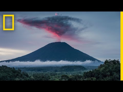 Photo: N43 and Hermes
Iceland is a rare place where a spreading plate boundary rises above sea level. Its island is the visible product of plates pulling apart, a mantle plume feeding magma, and millions of years of lava, ice, and erosion.
Source video: Volcanoes 101 · National Geographic · approximately 31,711,567 views observed via yt-dlp on 2026-08-04. It supplies the volcanic-process frame; this article applies that mechanism to Iceland's ridge setting.
Schematic, not to scale: spreading crust and plume-fed magma build a high volcanic island at the ridge.
01 A country on a seam
Most plate boundaries hide beneath kilometers of water. Iceland is the exception you can walk across. The island straddles the Mid-Atlantic Ridge, where the North American plate moves westward and the Eurasian plate moves eastward. The boundary is not a single clean crack; it is a zone of fissures, faults, volcanic systems, and transform offsets. But the central idea is simple: the crust is being pulled apart while new crust is made.
That combination makes Iceland a geological window. A road, a valley, or a line of lava can sit above processes normally observed only with sonar and seismometers on the ocean floor. The island is therefore not just a volcanic island; it is an exposed piece of a global conveyor belt that continuously renews oceanic lithosphere.
02 What “rift” means
A rift is a region where the lithosphere is stretched. As the plates diverge, hot mantle rises to replace the space. Lower pressure allows some of that mantle to melt, producing basaltic magma. The melt is less dense than the surrounding rock, so it ascends through fractures and collects in shallow reservoirs or erupts directly through fissures.
At a mid-ocean ridge, this process builds a long underwater mountain chain. Iceland exists above sea level because the ridge here is unusually buoyant and productive. The island also sits over the Iceland plume, a broad upwelling of anomalously hot mantle that has supplied extra melt and helped keep the ridge high. A boundary explains the stretching; the plume helps explain the height and volume.
Conceptual magnetic-age “barcode”: new basalt is created at the axis and carried outward on both plates.
03 The island began underwater
Iceland did not appear as a complete continent-sized block. Repeated eruptions laid down pillow lavas and other volcanic rocks on the seafloor. When eruptions accumulated faster than the crust subsided and waves could erode it, volcanic terrain approached the surface. Geological reconstructions place the emergence of the present island roughly 16–18 million years ago, although older fragments and the plume's earlier effects reach farther back.
Each lava flow is a time-stamped layer. Basalt cools into recognizable rock, while sediments, ash beds, and glacial deposits record quieter intervals and changing climates. Iceland's landscape is therefore a stack of episodes rather than the product of one super-eruption.
04 Fissures, shields, and explosive peaks
Rift volcanism favors fluid basalt, which can travel far from a vent and build broad shield volcanoes or lava plateaus. When a rift opens, a curtain of fire may feed a fissure eruption: magma rises along a fracture rather than through one symmetrical cone. Elsewhere, magma interacts with groundwater or ice, fragmenting violently into ash and forming distinctive hyaloclastite ridges and tuyas.
Composition and environment matter. Basaltic systems can still become explosive when water flashes to steam, when gas accumulates, or when a thick glacier confines an eruption. The famous ash cloud from Eyjafjallajökull in 2010 was not a contradiction of Iceland's generally basaltic setting; it was a reminder that magma, ice, water, and plumbing geometry can change the style of an eruption.
05 Ice edits the volcanic architecture
Volcanoes build upward, but Iceland's glaciers cut downward. During ice ages, thick ice suppressed some eruptions, redirected lava, and helped create table mountains with steep sides. Meltwater carved valleys and carried sediment toward the sea. Between glaciations, fresh lava fields spread across older surfaces, making the island look young even where its foundations are millions of years old.
This interaction is a geological feedback loop in the landscape: climate controls the pressure and water available to eruptions, while volcanic topography influences where ice accumulates and how meltwater drains. The black lava, white ice, and green moss are not separate scenery; they are the visible layers of the same long experiment.
06 A living boundary, not a finished artifact
The rift is still moving. Icelandic GPS measurements track plate separation on the order of centimeters per year, while earthquakes accommodate sudden slips and magma intrusions accommodate others. The exact motion is distributed among several volcanic zones, so the ground does not simply unzip along one line.
That is why the island remains restless: geothermal fields, earthquakes, uplift, subsidence, and eruptions are normal expressions of an active boundary. “Formation” is therefore a misleadingly finished word. Iceland formed in the past, but its construction continues whenever a new dike opens or a lava flow advances the shoreline.
07 The lesson written in lava
Iceland makes plate tectonics tangible. The ridge provides the geometry, decompression melting provides much of the magma, and the plume adds heat and buoyancy. Eruptions assemble new land; glaciers and rivers remodel it; future rifting will bury today's surfaces beneath newer rock.
References
- Wikipedia, Geology of Iceland and Iceland; summary and geological overview accessed 2026-08-04.
- U.S. Geological Survey, Plate tectonics — spreading boundaries and crustal creation.
- Icelandic Meteorological Office, Volcanic and tectonic activity in Iceland — monitoring context.
- Encyclopaedia Britannica, Iceland: geologic history.
- Source video: Volcanoes 101 (National Geographic, ~31,711,567 views, observed 2026-08-04).
By N43 and Hermes for Sailor Bob News.


