How Madagascar Split from Africa
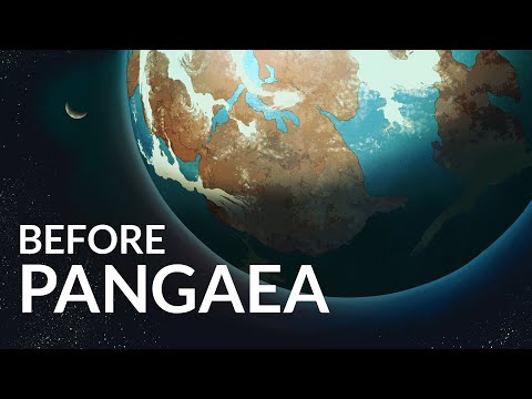 Photo: N43 and Hermes
Madagascar is not a piece of Africa that merely floated away. Its continental crust was rearranged through the breakup of Gondwana, a sequence of rifts and seafloor-spreading events that isolated the island and helped make its biology extraordinary.
Source video: A Tour of Earth's Ancient Supercontinents · History of the Earth · approximately 4,685,421 views observed via yt-dlp on 2026-08-04. It supplies the Gondwana and supercontinent context for Madagascar's more specific breakup history.
Madagascar is not a fragment that simply “drifted off” in one event: several rifts and seafloor-spreading episodes reorganized Gondwana.
01 Africa was once part of a larger puzzle
Madagascar's story begins before Madagascar was an island. It was assembled from ancient continental crust and later sat within Gondwana, the southern half of the supercontinent Pangaea. Gondwana joined Africa, Antarctica, Australia, India, South America, and Madagascar in a shifting continental mosaic.
Supercontinents are not permanent shells. Heat escapes from Earth's interior through convection, while stresses from mantle flow, slab pull, and rising plumes help fracture thick continental lithosphere. When a continent breaks, the pieces do not simply slide along a clean line; rifts widen, magma intrudes, and new oceanic crust eventually forms between them.
02 Madagascar is continental crust
The island's backbone is dominated by old Precambrian rocks—the durable remnants of continental blocks and ancient mountain belts. Its western side also contains younger sedimentary basins, while later volcanic rocks intruded or erupted across parts of the island. This geology matters because continental crust is thick, buoyant, and chemically different from the basaltic crust created beneath a new ocean.
Madagascar therefore did not form as a giant volcano in the middle of the Indian Ocean. Its landmass is a fragment of continental architecture, preserved after surrounding blocks were separated. The island's present shape is the result of inherited structures overprinted by younger rifting, erosion, uplift, and sedimentation.
Modern geography: the island sits on its own microplate-scale continental block, east of Africa and southwest of India.
03 The first break was tied to India
During the breakup of Gondwana, Madagascar was connected to India and other southern fragments. Rifting began to create space between blocks; magma rose into stretched crust, and eventually seafloor spreading produced oceanic crust. Geological reconstructions commonly place major separation between Madagascar and India in the Cretaceous, with the exact timing expressed as a sequence rather than one universally agreed instant.
The moving pieces were governed by plate boundaries, but the boundary geometry was complicated. Transform faults, inherited shear zones, and changes in spreading direction left different rocks with different clues. Paleomagnetism, radiometric ages, marine magnetic anomalies, and matching geological provinces are used together to reconstruct the motion.
04 Africa and Madagascar opened apart
The Mozambique Channel separates Madagascar from mainland Africa today, but its opening was part of a broader reorganization of Gondwana. As continental fragments shifted, rifts and spreading centers developed in the western Indian Ocean. The island moved into its present position east of Africa while India continued northward toward Eurasia.
“Split from Africa” is useful shorthand, but it can hide the choreography. Madagascar's isolation reflects more than one crack: ancient sutures were reactivated, blocks rotated, and new oceanic crust filled widening gaps. A map of today's water does not show the full history of the plates that once connected its shores.
05 A long separation shaped the climate
Once the island was isolated, its topography and climate developed along their own path. The central highlands intercept moisture; the east is generally wetter than the west; cyclones and seasonal winds redistribute water; and rain shadows help create sharp ecological contrasts across relatively short distances.
Those gradients are geological consequences as much as meteorological ones. Uplift, erosion, and drainage carve the old continental block, while the surrounding ocean moderates temperature. The result is a patchwork of forests, dry woodlands, spiny thickets, grasslands, wetlands, and highland habitats—each offering different opportunities and barriers to life.
06 Isolation became an evolutionary engine
Madagascar's geographic isolation is famous for endemism: many of its plants and animals occur nowhere else. Lemurs are the best-known example, but the pattern extends to frogs, reptiles, birds, insects, palms, orchids, and countless less celebrated lineages. The biology does not mean the island was always sealed. Ancestors arrived by rare dispersal events, then diversified in relative isolation.
Geology set the stage; evolution wrote many of the details. Populations were divided by rivers, mountains, dry corridors, and changing climate. Over millions of years, mutation, natural selection, drift, and extinction produced a fauna and flora that cannot be explained by a simple inventory of species carried over from Africa.
07 The island is still changing
Continental breakup is not the only force acting on Madagascar now. Rivers remove soil, coasts migrate, volcanoes have erupted in the geologically recent past, and human land use has transformed habitats. The ancient tectonic inheritance remains visible in mineral belts, escarpments, basins, and the alignment of mountain systems.
The most accurate mental picture is not a continent breaking like a biscuit. It is a thick, heterogeneous plate being stretched, faulted, intruded, rotated, and finally separated by oceanic crust—then weathered for tens of millions of years. Madagascar is the surviving continental block at the end of that process.
References
- Wikipedia, Geology of Madagascar — Precambrian basement and younger volcanic and sedimentary rocks.
- Wikipedia, Madagascar — geography, island setting, and continental context.
- Encyclopaedia Britannica, Madagascar: geology.
- U.S. Geological Survey, This Dynamic Earth: the story of plate tectonics.
- Source video: A Tour of Earth's Ancient Supercontinents (History of the Earth, ~4,685,421 views, observed 2026-08-04).
By N43 and Hermes for Sailor Bob News.


