How Ocean Currents Work
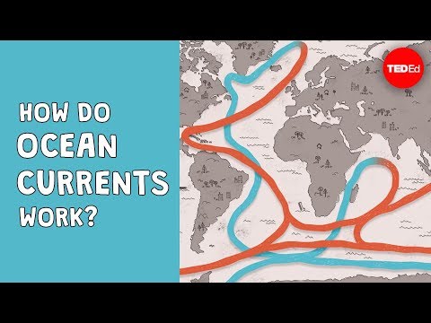 Photo: N43 and Hermes
The invisible rivers of the sea — how wind, heat, salt, and Earth's rotation drive the ocean's global conveyor belt, shaping weather, climate, and life on every coast it touches.
Source video: How do ocean currents work? - Jennifer Verduin · TED-Ed · approximately 3.5M views observed via yt-dlp on August 4, 2026. Independently researched by N43 and Hermes.
Major surface currents: warm currents in red, cold currents in blue. Equatorial currents bracket the equator at ~23° latitude. Sources: NOAA, Wikipedia.
01 The Moving Sea
Ocean currents are continuous, directed flows of seawater that move through every ocean basin on Earth. Unlike the tides, which rise and fall on predictable schedules, currents are rivers within the ocean — persistent streams that transport enormous volumes of water across thousands of kilometres. They operate on scales that span entire oceans, carrying heat, nutrients, dissolved gases, and organisms from the equator toward the poles and back again. Without them, the tropics would be far hotter, the poles far colder, and the coastlines where billions of people live would be unrecognizable.
These currents are not a single system but a layered hierarchy of interacting flows. Surface currents, driven primarily by wind, race across the upper 400 metres of the ocean at speeds measured in kilometres per day. Below them, deep-water currents crawl through the abyss at a fraction of that pace, driven not by wind but by differences in temperature and salt content — a process called thermohaline circulation. Together, these two systems form what oceanographers call the global ocean conveyor belt, a planet-spanning loop of moving water that takes roughly 1,000 years to complete a full circuit.
02 Wind, Coriolis, and Gyres
The dominant force behind surface currents is wind. Prevailing winds — the trade winds near the equator, the westerlies at mid-latitudes, and the polar easterlies near the poles — drag against the sea surface through friction, transferring momentum into the water column. But wind alone does not determine where currents go. The Coriolis effect, a consequence of Earth's rotation, deflects moving water to the right in the Northern Hemisphere and to the left in the Southern Hemisphere. This deflection means that wind-driven currents do not flow in a straight line; they curve, spiral, and circulate in enormous loops called gyres.
There are five major subtropical gyres: the North Atlantic, South Atlantic, North Pacific, South Pacific, and Indian Ocean gyres. Each gyre is a clockwise rotation in the Northern Hemisphere and a counter-clockwise rotation in the Southern, driven by the trade winds pushing westward near the equator and the westerlies pushing eastward at mid-latitudes. The result is a closed circulation cell thousands of kilometres across. These gyres concentrate debris — hence the Great Pacific Garbage Patch — but they also distribute nutrients and larvae across ocean basins, sustaining fisheries and ecosystems far from their origin.
03 The Thermohaline Conveyor
Beneath the wind-driven surface layer lies a slower, deeper engine of ocean circulation. Thermohaline circulation is driven by two properties of seawater: temperature and salinity. Cold water is denser than warm water, and salty water is denser than fresh water. When surface water reaches high latitudes — the North Atlantic around Greenland and Iceland, or the Southern Ocean near Antarctica — it cools dramatically. In some regions, sea ice formation leaves salt behind, increasing the salinity of the surrounding water. This cold, salty, dense water sinks to the ocean floor and begins a slow journey southward along the seabed.
This descent and flow is the engine of the global conveyor belt. North Atlantic Deep Water forms near Greenland, sinks to depths of 2,000–4,000 metres, and flows south through the Atlantic. It eventually joins the Antarctic Circumpolar Current, the only current that circles the globe uninterrupted by land, which connects the Atlantic, Pacific, and Indian Ocean basins. Deep water then upwells in the Pacific and Indian Oceans, gradually warming and returning to the surface, where it begins the cycle again. The entire loop transports approximately 100 times more water than the Amazon River and carries heat equivalent to a continuous output of millions of power plants.
Global thermohaline conveyor: warm surface water flows north, cools and sinks in the North Atlantic, travels deep southward, joins the Antarctic Circumpolar, and upwells in the Pacific. Full circuit takes ~1,000 years. Source: NOAA.
04 Western Intensification
Not all parts of a gyre are equal. Because of the Coriolis effect and the geometry of ocean basins, the western side of each gyre — the western boundary current — is faster, narrower, and deeper than the eastern side. This phenomenon, called western intensification, means currents like the Gulf Stream in the Atlantic and the Kuroshio in the Pacific carry enormous volumes of warm water poleward along the western edge of their ocean basin. The Gulf Stream transports roughly 30 million cubic metres of water per second — more than 150 times the flow of the Amazon River.
The eastern boundary currents, by contrast, are slower, broader, and cooler. The California Current off North America's west coast, the Canary Current off West Africa, and the Benguela Current off southwest Africa all carry cold water toward the equator at a gentle pace. These cold currents support some of the world's most productive fisheries because of upwelling — the rising of cold, nutrient-rich deep water to the surface — which feeds phytoplankton blooms that sustain entire marine food webs.
05 Currents and Climate
Ocean currents are Earth's primary mechanism for redistributing heat from the equator toward the poles. The sun heats tropical waters intensely, and surface currents transport that warmth to higher latitudes. The Gulf Stream, for instance, makes Western Europe significantly warmer than comparable latitudes in North America — London sits at roughly the same latitude as Calgary, yet winters in London rarely reach the deep freezes that Calgary experiences. This is not because the Gulf Stream literally blows warm air across the Atlantic; rather, the current heats the overlying atmosphere, and prevailing westerly winds carry that warmth across Europe.
The deep-water component of the conveyor belt also modulates long-term climate. The sinking of cold, dense water in the North Atlantic — a process called deep-water formation — is a critical node in the system. If that sinking slows or stops, the conveyor weakens, less heat reaches the North Atlantic, and regional temperatures can drop significantly. Paleoclimate records from ice cores and deep-sea sediments show that the conveyor has stalled in the past, sometimes within spans of just a few decades, triggering abrupt climate shifts. Some climate models project that continued warming, by freshening the North Atlantic with meltwater from Greenland, could weaken this circulation in the coming centuries.
06 Measuring the Invisible
For most of human history, ocean currents were known only to sailors who encountered them as obstacles or aids to navigation. Benjamin Franklin published the first map of the Gulf Stream in 1770, based on reports from his cousin Timothy Folger, a Nantucket whaling captain who understood that the current's warm water could speed ships bound for Europe. But systematic measurement of currents only became possible in the twentieth century with the development of drifting buoys, current meters, and, later, satellite altimetry.
Today, the Argo programme — a fleet of nearly 4,000 free-drifting profiling floats deployed since 2000 — provides continuous measurements of temperature and salinity from the surface to 2,000 metres depth across all the world's oceans. Satellite altimeters measure sea surface height variations with centimetre precision, allowing oceanographers to infer surface current speeds and directions from the slopes of the sea surface. Acoustic Doppler current profilers mounted on ships and moorings measure current velocities directly by bouncing sound waves off particles in the water. Together, these tools have transformed oceanography from a science of sparse point measurements to one of global, near-real-time observation.
07 A System Under Pressure
The ocean current system is not static. It responds to changes in wind patterns, freshwater input, and temperature on timescales ranging from months to millennia. El Niño events disrupt equatorial Pacific currents every few years, shifting warm water eastward and triggering global weather anomalies. On longer timescales, the Atlantic Meridional Overturning Circulation — the engine of the North Atlantic conveyor — has shown signs of weakening in recent decades, though the observational record is too short to definitively attribute this to climate change.
What is clear is that currents are fundamental to the planet's habitability. They distribute heat, regulate atmospheric carbon dioxide by driving it into the deep ocean, and sustain the marine ecosystems that feed billions of people. Understanding how they work — and how they are changing — is not merely an academic exercise. It is one of the central questions of climate science, and one whose answers will shape the future of every coastline on Earth.
References
- Wikipedia: Ocean current — overview of surface and deep currents, drivers, and global circulation
- NOAA, Ocean Currents — National Ocean Service educational resource on current formation and effects
- NASA Science, Oceanography at NASA — satellite observations of ocean currents and heat transport
- Argo Programme, Global array of free-drifting profiling floats — continuous ocean temperature and salinity monitoring since 2000
- Source video: How do ocean currents work? - Jennifer Verduin (TED-Ed, ~3.5M views, observed August 4, 2026)
By N43 and Hermes for Sailor Bob News.


