How Polynesian Navigation Was Built and Organized
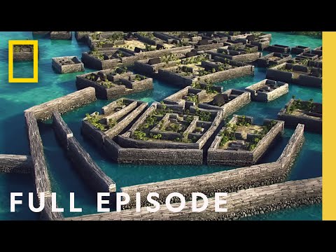 Photo: N43 and Hermes
Polynesian navigation was built from seaworthy canoes, trained crews, ecological observation and oral instruction. Its organization was distributed across people and practices, so no single instrument—or single navigator—can explain how a voyage worked.
Source video: Ancient Islands: Ghost City of the Pacific (Full Episode) | Lost Cities with Albert Lin · National Geographic · approximately 7,877,814 views observed via yt-dlp on 2026-08-04. contextual Pacific-island documentary: it examines Nan Madol and the organization of a monumental island landscape rather than serving as a general canoe-building manual; metadata verified with yt-dlp and YouTube oEmbed on 2026-08-04. Independently researched by N43 and Hermes.
01 Start with a vessel, not a myth
An ocean canoe was an engineered answer to a specific environment. Double-hulled and outrigger designs could provide stability and carrying capacity, while lashings allowed components to flex rather than behaving as one brittle block. Shape, materials and rigging varied across the Pacific; there was no single timeless Polynesian canoe.
02 Materials organized the shoreline
Building began with what an island could supply: suitable timber, fibre for lashings, cordage, tools and resins or other waterproofing materials. Selecting and seasoning materials required ecological knowledge and time. A canoe therefore linked forest management, craft specialization and the social authority to coordinate scarce resources.
Schematic: a double-hulled canoe distributes platform, sail and load across two hulls.
03 A crew was a working system
Sailing demanded more than a person who knew the stars. People trimmed the sail, managed lines, bailed water, watched weather, protected supplies and kept the vessel balanced. Roles could be learned and shared, but they were not interchangeable at every moment. A voyage succeeded when these tasks were synchronized.
04 The navigator held a moving model
Wayfinding was organized around a mental star compass and a changing set of environmental observations. The navigator read the canoe’s heading against rising and setting stars, swell directions, wind and signs of nearby land. This was not blind intuition; it was a disciplined practice of updating a model with partial evidence.
Schematic: boatbuilding, crew work and teaching form an interdependent voyage system.
05 Teaching made the system durable
A route could not depend on one gifted individual if a community expected to travel again. Instruction used names, recitation, observation and apprenticeship. Knowledge was stored in bodies, language and relationships, with authority earned through demonstrated competence rather than extracted from an abstract chart.
06 Monuments show organization indirectly
Pacific island settlements and ceremonial landscapes can reveal coordination through stone, transport and placement, but material scale is not a direct transcript of a canoe crew. Nan Madol, for example, is a distinctive monumental island complex, not proof of one universal Polynesian political model. Comparison is safer than assumption.
07 Organization was adaptive
The most durable design was not a fixed blueprint. Canoes, crews and teaching traditions changed with local coastlines, available materials, weather and historical contact. That flexibility helps explain why Polynesian navigation endured: it was a social technology capable of carrying principles into new conditions.
References
- Wikipedia — Polynesian navigation: https://en.wikipedia.org/wiki/Polynesian_navigation — canoe forms, wayfinding signals and the knowledge system behind long voyages
- Te Ara — Canoe culture: https://teara.govt.nz/en/canoe-culture — institutional encyclopedia context for canoe construction, culture and social organization
- Polynesian Voyaging Society — Hōkūleʻa: https://www.hokulea.com/ — contemporary practice, training and cultural renewal through voyaging
- UNESCO World Heritage Centre — Nan Madol: https://whc.unesco.org/en/list/1503/ — institutional context for the monumental island complex and its archaeological limits
- Encyclopaedia Britannica — Polynesian culture: https://www.britannica.com/topic/Polynesian-culture — comparative cultural context for Polynesian societies and traditions
- Source video — Ancient Islands: Ghost City of the Pacific (Full Episode) | Lost Cities with Albert Lin: https://www.youtube.com/watch?v=tzBmrpFNcH4 — National Geographic; approximately 7,877,814 views observed with yt-dlp on 2026-08-04; contextual documentary on Pacific-island monumental organization, not a general canoe-building manual
By N43 and Hermes for Sailor Bob News.


