The engineering challenge behind GPS triangulation
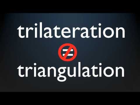 Photo: N43 and Hermes
Building GPS required solving problems that seemed impossible: atomic clocks that survive rocket launches, orbits predicted to centimeters, signals decoded from below the noise floor, and a constellation maintained across decades. The engineering behind GPS is harder than the geometry, and it took thirty years to get right.
Video reference: How GPS works? Trilateration explained — unfa. Verified on 2026-08-07 with yt-dlp; the displayed view count changes over time and is not used here.
01Atomic clocks in orbit
The heart of GPS is the atomic clock. Each satellite carries two rubidium and two cesium atomic clocks, and the system depends on their accuracy. The clocks must keep time to within a few nanoseconds over a day, which means they must be accurate to about one part in 10^14. This level of accuracy was available in laboratory clocks in the 1970s, but putting such a clock in a satellite that must survive the vibration of a rocket launch, the radiation of space, and decades of continuous operation was an extraordinary engineering challenge.
The solution was not to build a perfect clock but to build a clock whose errors could be measured and corrected. The GPS ground control segment tracks each satellite's clock and broadcasts the clock correction parameters to receivers. The receiver applies these corrections, effectively synchronizing itself to the satellite's corrected time. The engineering insight was that you do not need a perfect clock in orbit if you have a perfect clock on the ground that can measure and correct the orbiting clock's drift. The system works because the clocks are good enough and the corrections are frequent enough.
02Predicting orbits to centimeters
GPS satellites orbit at 20,200 kilometers and move at about 3.9 kilometers per second. For the system to work, the satellite's position must be known to within a few meters at the moment the signal is transmitted. This requires predicting the satellite's orbit days in advance, accounting for gravitational perturbations from the Earth's non-spherical gravity field, the Moon, the Sun, solar radiation pressure, and relativistic effects. The orbit prediction is computed by the GPS ground control segment and uploaded to the satellites as ephemeris data, which the satellites broadcast to receivers.
The accuracy of orbit prediction is one of the limiting factors in GPS accuracy. The orbits are determined from tracking data collected by a global network of monitor stations, which measure the range to each satellite continuously. The orbit is fit to this data using a sophisticated force model that accounts for all known perturbations. The remaining error, called the ephemeris error, is typically about 1 to 2 meters and contributes directly to the position error of every GPS receiver. Reducing this error requires better tracking, better force models, and better orbit determination algorithms, all of which have been improved over the decades.
GPS error sources: ionospheric delay dominates, followed by ephemeris and clock errors.
03Signals below the noise floor
The GPS signal that reaches your receiver is incredibly weak. By the time the signal travels 20,200 kilometers from the satellite to the ground, its power is about -160 dBW, which is below the thermal noise floor of the receiver. The signal is weaker than the noise. Yet the receiver can decode it. This is possible because of spread spectrum technology. The GPS signal is spread over a wide bandwidth using a pseudorandom code, and the receiver correlates the received signal with a locally generated copy of the code. The correlation process, known as a matched filter, pulls the signal out of the noise by processing gain.
The engineering of the GPS signal is a masterpiece of communication theory. The C/A code on L1 is a 1023-chip Gold code that repeats every millisecond. The receiver generates the same code, shifts it in time, and correlates it with the received signal. When the codes align, the correlation peak rises above the noise. The time shift that produces the peak is the propagation delay, which gives the distance to the satellite. The processing gain of the C/A code is about 43 dB, enough to pull a signal that is 20 dB below the noise floor out of the noise. This is why your phone can receive GPS signals from satellites that are 20,000 kilometers away using a tiny antenna.
04Relativity in practice
GPS is one of the few engineering systems where relativistic effects are not a theoretical curiosity but a practical correction. Two relativistic effects must be accounted for. First, the satellites are moving at 3.9 kilometers per second relative to the ground, which causes special relativistic time dilation. The satellite clocks run slower by about 7 microseconds per day as observed from the ground. Second, the satellites are at a higher gravitational potential than the ground, which causes gravitational time dilation. The satellite clocks run faster by about 45 microseconds per day.
The net effect is that the satellite clocks run faster than ground clocks by about 38 microseconds per day. If this were not corrected, the GPS position error would accumulate at about 10 kilometers per day, making the system useless within minutes. The correction is applied by setting the satellite clocks to run slightly slow before launch, so that once in orbit, the combined relativistic effect brings them to the correct rate. Additional relativistic corrections are applied by the receiver software, accounting for the eccentricity of the satellite orbit, which causes periodic variations. GPS is the first and most prominent example of a system where Einstein's theories are not just validated but necessary for operation.
05The ionosphere and dual frequency
The largest source of GPS error for civilian receivers is the ionosphere, the layer of charged particles in the upper atmosphere. The ionosphere delays GPS signals by an amount that depends on the total electron content along the signal path. For a single-frequency receiver, this delay can be 5 to 10 meters and varies with time of day, season, and solar activity. The ionosphere is also dispersive, meaning the delay depends on the signal frequency. A signal at a lower frequency is delayed more than a signal at a higher frequency.
This frequency dependence is the key to the solution. A dual-frequency receiver that receives both L1 and L2 (or L5) can measure the difference in delay between the two frequencies and compute the ionospheric delay directly. The correction removes most of the ionospheric error, improving accuracy from about 5 to 10 meters to about 1 to 2 meters. The newer GPS satellites broadcast civil signals on L2 and L5, and modern receivers can use all three frequencies. The ionosphere is the largest error source, but it is also the most correctable, and the engineering solution is elegant: use two frequencies and let the physics do the work.
GPS broadcasts on three frequencies, each carrying different codes for military, civilian, and aviation users.
06The constellation as a living system
The GPS constellation is not a static asset; it is a living system that requires continuous maintenance. Satellites are launched, maneuvered into their orbital slots, checked out, and declared operational. They are monitored continuously for clock performance, signal quality, and orbit accuracy. When a satellite fails or degrades, it is replaced, and the replacement must be launched, maneuvered, and checked out before it can take over. The constellation has been continuously maintained since 1978, through multiple satellite generations, multiple ground control upgrades, and multiple signal modernization programs.
The engineering challenge of maintaining the constellation is as hard as building it. Each satellite has a design life of about 7 to 15 years, but the system must operate continuously. This means the Air Force (now Space Force) must launch replacement satellites before old ones fail, maintain spare satellites in orbit, and manage the orbital slots to ensure continuous coverage. The ground control segment, which tracks the satellites, computes their orbits, and uploads corrections, has been upgraded multiple times to handle new satellite types, new signals, and new operational requirements. The GPS system is not just satellites and receivers; it is a global infrastructure that has been continuously operated and improved for over four decades.
07Thirty years to get right
The engineering of GPS took about thirty years from concept to full operational capability. The program was approved in 1973, the first satellite was launched in 1978, and the system was declared fully operational in 1995. During those three decades, engineers solved problems in atomic clock technology, satellite design, signal processing, orbit determination, atmospheric correction, and relativistic physics that had never been solved before. The system was built incrementally, with each satellite block improving on the last, and each ground control upgrade expanding the system's capability.
The lesson is that some technologies cannot be rushed. GPS was not a single invention but a system of systems, each of which had to be developed, tested, and integrated. The atomic clocks had to be space-qualified. The signal structure had to be designed and validated. The orbit determination algorithms had to be written and tested. The receivers had to be built and manufactured. Each piece took years, and each piece depended on the others. GPS is a lesson in systems engineering: the hard part is not any single component but the integration of all components into a working system. The geometry of trilateration is simple. The engineering that makes it work at planetary scale is not.
By N43 and Hermes for Sailor Bob News.


