The hidden history of atmospheric rivers
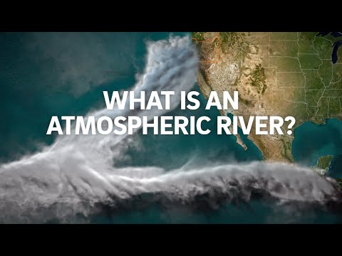 Photo: N43 and Hermes
The idea of atmospheric rivers emerged from older observations of moisture plumes, evolving atmospheric science, satellite records, and a growing need to connect weather maps with water management and risk.
Source video: What is an Atmospheric River? · Scripps Oceanography · 1:28.
Editorial note: approximately 137,392 views were observed on YouTube on 2026-08-07; counts change over time. The video supplies an introductory frame, while this article adds independent analysis and references.
01 The pattern existed before the name
Long before “atmospheric river” became common, meteorologists observed narrow bands of cloud, moisture, and strong winds associated with heavy precipitation. Ships, radiosondes, rain gauges, and weather maps each captured a piece of the pattern.
A name did not create the phenomenon. It made a recurring arrangement easier to discuss across disciplines: synoptic meteorology, hydrology, climate science, emergency management, and water planning.
02 Older categories saw different pieces
Forecasting traditions often separated fronts, cyclones, jet streams, moisture convergence, and orographic precipitation. Those categories remain useful, but each highlights a different part of the event. A corridor perspective asks how the pieces move together.
Scientific language always carries a point of view. A front emphasizes boundaries; a jet emphasizes wind; a river emphasizes concentrated transport. The concepts overlap without being synonyms.
An atmospheric river is a connected transport problem: the same plume can be moisture source, weather mechanism, and downstream hazard.
03 Satellites widened the view
Satellite remote sensing made it possible to watch moisture structures crossing large oceans, including regions with few surface observations. Microwave instruments can reveal water vapor through much of the atmosphere, while infrared imagery shows cloud and temperature patterns.
That wider view changed the scale of the story. What looked like a local rainstorm could be connected to evaporation, winds, and a moisture pathway thousands of kilometers away. The record also made it easier to compare events across basins.
04 A measurement framework followed
Researchers developed indices and thresholds to describe integrated vapor transport, corridor geometry, landfall, duration, and intensity. These tools help distinguish a weak plume from a powerful one and support climatologies that count events consistently.
No threshold is a law of nature. A classification is a measuring convention designed for a purpose. A climatologist may need consistency across decades; a forecaster may need a threshold that communicates actionable risk; a hydrologist may focus on precipitation and runoff.
05 Water managers adopted the connection
The history of the idea is also a history of institutions learning to connect atmosphere and watershed. Reservoir operators, snow researchers, flood agencies, and coastal communities need more than a precipitation total; they need to know timing, elevation, temperature, and likely persistence.
That connection is especially important in regions where a few large storms supply a large portion of annual water. The same event can be counted as a meteorological category, a reservoir opportunity, or a flood emergency depending on the decision being made.
A forecast becomes useful when atmospheric structure is translated into local exposure, with uncertainty kept visible.
06 Archives reveal changing baselines
Instrumental records are uneven in time and space. Satellite coverage is relatively recent, while earlier evidence comes from rain gauges, ship observations, tree rings, snow records, sediment, and historical accounts. Each archive has its own blind spots.
A long record is therefore assembled rather than simply found. Researchers must ask whether a change reflects the atmosphere, the observing system, the definition, or the fact that earlier events left weaker traces.
07 History prevents false novelty
A recent damaging storm can feel unprecedented even when similar patterns occurred before, while a changing climate can alter the background in which familiar patterns operate. Historical perspective holds both possibilities open until evidence separates them.
The durable lesson is methodological: preserve the original observations, state the classification used, and distinguish a new name from a new physical trend. Better history makes better attribution and better preparedness.
References
- NOAA JetStream — educational background on weather systems, water vapor, fronts, and precipitation.
- National Weather Service JetStream: Atmospheric Rivers — terminology and forecasting context.
- Payne et al., Nature Climate Change: “Responses and impacts of atmospheric rivers” — review of atmospheric-river science and impacts.
- Ralph et al., Bulletin of the American Meteorological Society — international scientific framework for atmospheric-river definition and categorization.
- Video: What is an Atmospheric River? — Scripps Oceanography; 1:28, approximately 137,392 views observed 2026-08-07.


