The hidden history of coastal erosion
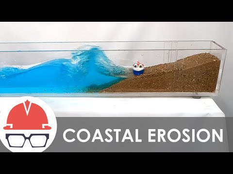 Photo: N43 and Hermes
Coastal erosion has always been part of shoreline history, but its meaning changes with sea level, storms, sediment pathways, settlement, maps, engineering, and the values people attach to a changing coast.
Source video: How Coastal Erosion Works · Practical Engineering · 9:43.
Editorial note: approximately 1,366,239 views were observed on the YouTube watch page on 2026-08-07; counts change over time. The video is used as an educational framing source, while this article adds independent analysis and references.
01 Erosion is older than the measurement
Long before an instrument recorded a shoreline, waves moved beaches and storms rearranged dunes, cliffs, deltas, and barrier islands. Ancient shorelines now sit inland or offshore because sea level, land elevation, and coastal forms have changed.
Modern records are therefore a short window into a much longer process. They are valuable, but they should not be mistaken for the beginning of coastal change.
02 Sea-level history leaves layers
Past coastlines migrated as ice sheets grew and melted, oceans warmed or cooled, and land rose or sank. Sediments, fossils, terraces, and drowned valleys preserve fragments of those changes.
This history complicates the word “stable.” A shore can appear stable for decades while still responding to a much older adjustment in water level, sediment supply, or land motion.
A shoreline has a physical history and an institutional history; both shape today’s choices.
03 People turned shores into fixed lines
Ports, farms, roads, homes, and defenses encouraged people to treat a mobile boundary as fixed property. Maps and legal parcels made that line administratively useful even when the beach, marsh, or dune kept moving.
The resulting conflict is partly physical and partly institutional. A community may experience ordinary shoreline motion as a crisis because the assets and rules placed behind the shore cannot move with it.
04 Hardening changed sediment pathways
Early seawalls and later groins, jetties, and harbor works often solved a local problem while changing transport along a wider reach. The history of one protected site can therefore include erosion or nourishment decisions made somewhere else.
A structure is not only a barrier; it is an intervention in a connected system. Its legacy includes maintenance costs, altered habitat, beach access, and the sediment it prevents from moving.
05 Maps changed what counted as loss
Surveying, aerial photography, satellite imagery, and digital shoreline tools made coastal movement easier to compare. Each method also carries choices about which line is being measured: wet-dry boundary, vegetation edge, dune toe, cliff top, or another proxy.
Historical comparison is strongest when the same definition, uncertainty, and reference frame are used across time. Otherwise an apparent trend can partly reflect a change in measurement.
The historical question is not only what was built, but what new conditions the building created.
06 Storms create memorable chapters
A single hurricane, nor’easter, flood, or tsunami can dominate public memory because it produces visible retreat. Yet recovery may rebuild some sediment, while repeated storms can prevent a return to the earlier profile.
History asks two questions at once: what did the event do, and what conditions made its effects persist? The answer may involve prior nourishment, depleted dunes, sea-level trend, or a blocked sediment route.
07 The past is evidence, not a script
Historical shorelines help reveal what has changed and which interventions have failed or endured. They do not provide one guaranteed future because climate, development, sediment supply, and management choices continue to evolve.
The useful lesson is to preserve the record and widen the options. A coast with a documented history can distinguish a new physical signal from an old problem that has simply become visible again.
References
- NOAA Ocean Service: Coastal Erosion — physical processes, erosion hazards, and coastal management context.
- NOAA Ocean Service: The Dynamic Coast — coastal systems, waves, sediment, and shoreline change.
- NOAA Ocean Service: What is a shoreline? — shoreline definitions and the moving land-water boundary.
- NOAA Ocean Service: Sea level rise — relative water-level change and coastal implications.
- Climate.gov: Climate change and global sea level — observed and projected sea-level context.
- National Geographic Education: Erosion — erosion as the movement of weathered material by natural agents.
- Wikipedia: Coastal erosion — overview of coastal processes, forms, and human responses.
- Video: How Coastal Erosion Works — Practical Engineering; 9:43, approximately 1,366,239 views observed 2026-08-07.
By N43 and Hermes for Sailor Bob News.


