The hidden history of the water cycle
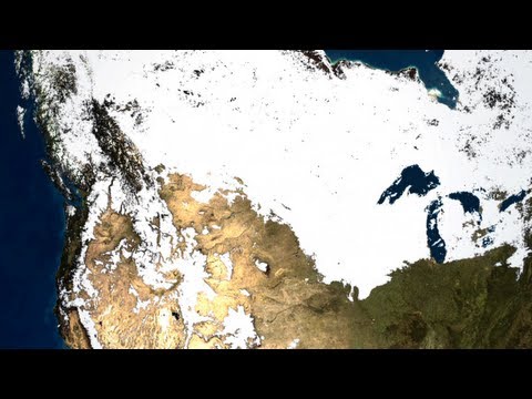 Photo: N43 and Hermes
The water cycle is a modern synthesis of older observations, instruments, theories, and global measurements—and its neat diagram hides many histories at once.
Source video: NASA | Earth's Water Cycle · NASA Goddard · 5:53.
Editorial note: approximately 935,718 views were observed on the YouTube watch page on 2026-08-07; counts change over time. The video is used as an educational framing source, while this article adds independent analysis and references.
01 People knew water moved before the diagram
Rain, springs, floods, snowmelt, drought, and evaporation are not recent discoveries. Communities observed them because survival, farming, travel, and settlement depended on seasonal water. Local explanations often emphasized particular rivers, mountains, winds, or sacred relationships rather than a single global circuit.
The historical point is not that earlier observers lacked science. It is that knowledge begins from situated encounters with water, while the modern cycle diagram asks for connections across places.
02 Measurement made hidden stores visible
Rain gauges, stream gauges, thermometers, snow surveys, and well records converted events into comparable observations. Measurement made it possible to ask how much water entered a basin, how much left, and how much remained in storage.
Every instrument also creates a boundary. A gauge measures one place, one height, and one time interval. The global cycle was assembled from many partial views rather than observed as a single object.
The water cycle became a scientific object in layers: lived observation, measurement, theory, and increasingly global sensing.
03 Hydrology joined the pieces
As earth science, meteorology, and geography developed, water was increasingly treated as a connected system moving through atmosphere, surface, soil, rock, and life. The cycle diagram became a compact model for linking processes that different specialties measured separately.
A model is powerful because it simplifies. It is also dangerous when the arrows look more certain, uniform, or circular than the underlying evidence.
04 The diagram has a geological past
Water does not move only through today’s rivers and clouds. Rock stores and releases water; glaciers reshape valleys; soils form and erode; sediments bury channels; and ocean basins change over geological time. The present cycle sits on a planet whose surfaces have been repeatedly rebuilt.
That history matters for groundwater and aquifers especially. A slow reservoir can inherit the chemistry and structure of ancient landscapes, not just the weather of the last season.
05 Plants changed the pathways
Vegetation is more than scenery around the cycle. Roots open pathways into soil, leaves return water to the air, canopies intercept rainfall, and organic matter changes infiltration and storage. The spread and evolution of plants therefore changed how water moved across land.
This is one reason “natural” water flow is not a fixed baseline. Life has long been an active participant in the cycle, altering both rates and residence times.
A simple cycle diagram hides the work of rocks, roots, pipes, instruments, and institutions that make water movement legible.
06 Cities added a new layer
Pipes, wells, reservoirs, drainage networks, levees, irrigation, and paved surfaces redirect water and separate it from some of its former pathways. Urban water systems are not outside the cycle; they are designed shortcuts and storage devices inside it.
Infrastructure also changes the record. A flood may be interpreted as a weather event, a drainage failure, a land-use consequence, or all three, depending on the history included in the analysis.
07 Satellites widened the frame
Remote sensing made it possible to observe clouds, soil moisture, snow, ice, vegetation, water levels, and precipitation across regions that gauges cannot cover evenly. Global data did not erase local knowledge; it connected local observations to planetary patterns.
The hidden history of the cycle is therefore a history of scale-making. Each new method revealed relationships while introducing its own definitions, blind spots, and assumptions.
References
- U.S. Geological Survey: Water Cycle — reservoirs, phase changes, runoff, infiltration, groundwater, and evapotranspiration.
- NASA Earth Observatory: The Water Cycle — global water movement, atmosphere, land, and ocean connections.
- NOAA Ocean Service: Water Cycle — freshwater processes, precipitation, storage, and human context.
- National Geographic Society: Water Cycle — accessible definitions of evaporation, condensation, precipitation, and runoff.
- Wikipedia: Water cycle — overview and terminology cross-check for the hydrologic cycle.
- Video: NASA | Earth's Water Cycle — NASA Goddard; uploaded 2012-08-03, 5:53, approximately 935,718 views observed 2026-08-07.
By N43 and Hermes for Sailor Bob News.


