The Science of Earthquakes
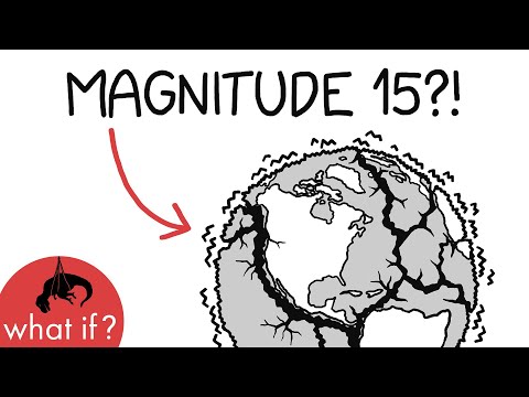 Photo: N43 and Hermes
How tectonic forces, seismic waves, and fault mechanics combine to produce the most destructive geological events on Earth — and why predicting them remains one of science's hardest problems.
Source video: What would a magnitude 15 earthquake be like? · xkcd's What If? · approximately 7.9M views observed via yt-dlp on August 4, 2026. Independently researched by N43 and Hermes.
Chart 1: The Richter scale is logarithmic — each whole-number increase represents roughly 32 times more energy release. A magnitude 8 quake releases over 1,000 times the energy of a magnitude 6. Source: USGS energy equivalents.
01 The Restless Planet
An earthquake is the shaking of the Earth's surface resulting from a sudden release of energy in the lithosphere that creates seismic waves. The Earth's outer shell is not a single solid dome but a mosaic of enormous rigid slabs called tectonic plates, and these plates are in constant motion — driven by heat from the planet's interior, they creep across the globe at rates of a few centimeters per year, about the speed fingernails grow. Where plates meet, enormous forces accumulate as rock is stretched, compressed, or sheared. When the accumulated stress exceeds the frictional strength holding the rock together, the fault ruptures, releasing decades or centuries of stored elastic energy in a matter of seconds.
The global picture is staggering. The USGS estimates that around 500,000 earthquakes occur each year detectable by instruments — only about 100,000 of these are felt by people, and roughly 100 cause damage. Most are small and harmless, concentrated along the boundaries where tectonic plates collide, separate, or slide past one another. But the rare large events, with magnitudes above 7, can devastate entire cities, reshape coastlines, and trigger secondary disasters from tsunamis to landslides to nuclear meltdowns. The intersection of deep geological processes with human civilization makes earthquakes uniquely destructive among natural hazards.
02 Plate Boundaries and Fault Types
Earthquakes are not randomly distributed. They cluster along the boundaries of tectonic plates, where the Earth's lithosphere is being created, consumed, or sheared. There are three principal boundary types, and each produces a characteristic style of faulting. At divergent boundaries, plates pull apart and new crust forms from upwelling magma — the Mid-Atlantic Ridge is the classic example, mostly underwater but seismically active. At convergent boundaries, one plate dives beneath another in a process called subduction, producing the most powerful earthquakes on Earth. At transform boundaries, plates grind horizontally past each other — the San Andreas Fault in California is the most famous, where the Pacific Plate slides northward against the North American Plate.
Faults themselves are classified by the direction of movement. Dip-slip faults involve vertical displacement — in a normal fault, the hanging wall drops down (extensional forces, common at divergent boundaries), while in a reverse fault, it is thrust upward (compressional forces, common at convergent boundaries). Strike-slip faults involve horizontal sliding, as at transform boundaries. Megathrust faults at subduction zones combine both, with enormous thrust sheets overriding the descending plate. The largest earthquakes ever recorded — including the 1960 Valdivia earthquake in Chile (magnitude 9.5) and the 2004 Sumatra earthquake (magnitude 9.1–9.3) — were megathrust events at subduction zones.
Chart 2: Earthquake depth varies dramatically by fault type. Divergent and transform faults produce shallow quakes (under 70 km), while subduction zones generate deep-focus earthquakes reaching 700 km — the deepest ever recorded. Source: USGS, IRIS.
03 Seismic Waves: P, S, and Surface
When a fault ruptures, the released energy propagates outward as seismic waves — mechanical waves of acoustic energy traveling through the Earth's interior and along its surface. Two fundamental body waves radiate from the hypocenter, the point within the Earth where rupture begins. Primary waves (P-waves) are compressional, alternately squeezing and stretching the rock in the direction of travel. They are the fastest, racing through the crust at 5–8 km/s, and can travel through both solids and liquids. Secondary waves (S-waves) are shear waves, moving material perpendicular to the direction of travel. They are slower, at 3–5 km/s, and cannot pass through liquids — a property that helped geophysicists infer the Earth's molten outer core.
When P and S waves reach the surface, they generate surface waves, which travel along the Earth's exterior and cause most of the shaking we feel. Love waves move the ground horizontally from side to side, while Rayleigh waves create a rolling, elliptical motion — the most destructive of all, often responsible for the collapse of buildings. A single magnitude 7 earthquake can produce Rayleigh waves detectable around the world, traveling at roughly 3 km/s and circling the globe multiple times before dissipating. The time delay between P-wave and S-wave arrival at a seismometer is the key to locating the earthquake's epicenter: the further the station, the longer the gap.
04 Measuring Magnitude and Intensity
Earthquake size is measured in two fundamentally different ways. Magnitude describes the total energy released at the source — a single number per earthquake, independent of distance. The Richter scale, developed by Charles Richter and Beno Gutenberg in 1935, was the original magnitude scale, based on the maximum amplitude of seismic waves recorded by a specific type of seismometer at a standard distance. It is logarithmic: each whole-number step represents roughly 32 times more energy. Modern seismology uses the moment magnitude scale (Mw), which is physically grounded in the seismic moment — the product of the fault area, the average slip, and the rigidity of the rock. For large earthquakes, Mw is more accurate than Richter's local magnitude, and it is the standard reported by the USGS.
Intensity, by contrast, describes the severity of shaking at a particular location — it varies with distance from the epicenter, local geology, and building construction. The Modified Mercalli Intensity scale, rated from I (not felt) to XII (total destruction), is the most widely used intensity scale in the United States. A single earthquake has one magnitude but many intensities: the 1906 San Francisco earthquake had an estimated magnitude of 7.9, but its intensity ranged from VIII near the fault to II in distant locations. Intensity maps, compiled from citizen reports and instrument data, are critical for emergency response and structural engineering.
05 The Ring of Fire and Global Hotspots
Roughly 90% of the world's earthquakes occur along the Pacific Ring of Fire, a horseshoe-shaped belt of seismic and volcanic activity that traces the margins of the Pacific Ocean. The Ring of Fire spans from New Zealand up through Indonesia, the Philippines, Japan, the Aleutian Islands, and down the western coast of the Americas to Chile. It is the surface expression of the Pacific Plate being consumed at subduction zones around its entire perimeter — the deepest earthquakes on Earth, reaching 700 km, occur in the Tonga Trench where the Pacific Plate dives beneath the Australian Plate.
Major earthquake-prone regions outside the Ring of Fire include the Alpine-Himalayan belt, stretching from the Mediterranean through Turkey, Iran, and the Himalayas to Southeast Asia, where the collision of the African, Arabian, and Indian plates with Eurasia produces frequent devastating events. The 2015 Gorkha earthquake in Nepal (magnitude 7.8) killed nearly 9,000 people along this belt. Intraplate earthquakes, occurring far from plate boundaries, are rarer but can be extremely destructive — the 1811–1812 New Madrid earthquakes in the central United States, estimated at magnitude 7.5–8.0, remain among the largest recorded in North America, and their recurrence potential remains a concern for infrastructure planners.
06 Why Prediction Remains Impossible
Despite decades of research, earthquake prediction — specifying the time, location, and magnitude of a future earthquake with useful precision — remains beyond the reach of modern science. The problem is fundamentally one of scale and complexity. Fault systems are heterogeneous at every scale, from microscopic grain boundaries to hundreds of kilometers of fault geometry. The stress state at depth cannot be measured directly, only inferred from indirect geophysical observations. And the nucleation of rupture, which begins as a tiny slip on a small patch of the fault, is sensitive to conditions that are impossible to observe in real time. The rock itself behaves nonlinearly: it stores elastic energy over decades and releases it in seconds, and the transition from slow creep to dynamic rupture is governed by friction laws that depend on temperature, pressure, pore fluid, and the history of past slip.
What seismology can do is forecast — assessing the long-term probability of earthquakes in a region based on historical seismicity, fault slip rates, and geodetic measurements of crustal deformation. The USGS produces seismic hazard maps that quantify the probability of damaging shaking over 50-year periods, guiding building codes and infrastructure investment. Short-term forecasting, on the timescale of days to weeks, remains experimental. Statistical phenomena like foreshock sequences and earthquake swarms can indicate elevated risk, but their predictive value is limited — most small earthquakes are not followed by large ones. The search for reliable precursors, from radon gas emissions to electromagnetic anomalies to animal behavior, has produced tantalizing leads but no validated method. For now, the most effective defense against earthquakes remains engineering: designing buildings, bridges, and infrastructure to withstand the shaking they will inevitably experience.
07 Engineering Against the Shake
Earthquake engineering has evolved from empirical trial-and-error to a sophisticated discipline combining structural dynamics, materials science, and computational simulation. The fundamental insight is that earthquake forces are inertial: the ground moves, and the building resists, so the upper floors experience accelerations that can amplify ground motion by a factor of two or more. Modern seismic design codes address this through a combination of strength, ductility, and damping. Base isolation decouples the building from the ground using flexible pads or bearings — the building essentially floats, following the ground motion slowly rather than being jolted. This technique has proven remarkably effective: isolated buildings in the 2011 Tohoku earthquake experienced shaking forces reduced by 70–80% compared to fixed-base structures.
For existing buildings, retrofitting is the challenge. Older structures built before modern seismic codes — unreinforced masonry, concrete without adequate detailing, soft-story apartment buildings — are the most vulnerable. Techniques like steel jacketing, carbon fiber wrapping, and the addition of shear walls can dramatically improve performance, but the cost is substantial and implementation is uneven. The tragic 2023 Turkey–Syria earthquake sequence, which killed over 59,000 people, demonstrated the catastrophic consequences of inadequate construction: thousands of buildings collapsed simultaneously, many of them recent construction that should have withstood the shaking. The lesson, repeated after every major earthquake, is that the built environment — not the geological hazard itself — determines the human toll.
References
- Wikipedia: Earthquake — overview of seismic phenomena, causes, and measurement
- Wikipedia: Seismic wave — P-waves, S-waves, and surface waves
- Wikipedia: Richter scale — historical magnitude measurement
- Wikipedia: Ring of Fire — Pacific seismic belt
- USGS Earthquake Hazards Program, usgs.gov/programs/earthquake-hazards — real-time monitoring and research
- IRIS Consortium, iris.edu — seismological data and education
- Source video: What would a magnitude 15 earthquake be like? (xkcd's What If?, ~7.9M views, observed August 4, 2026)
By N43 and Hermes for Sailor Bob News.


