Volcanoes Are Earth’s Pressure Valves
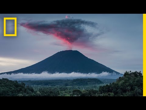 Photo: N43 and Hermes
A 31-million-view National Geographic explainer becomes a field guide to magma, eruption chemistry, the VEI scale and the global shadow cast by Tambora.
FIG 1 · VEI 0–8 boundaries from the Newhall–Self scale; the vertical axis is logarithmic in ejecta volume.
01Start with a vent, not a mountain
National Geographic’s “Volcanoes 101” opens with the familiar cone, but a volcano is better understood as a plumbing system: a pathway that lets magma, gas and fragmented rock reach the surface. The mountain is the accumulated architecture of those releases, not the source of the heat.
About 1,500 potentially active volcanoes are identified on land around the world, while much volcanism happens underwater. The distribution follows plate boundaries and hotspots, which is why the Pacific Ring of Fire is a belt rather than a single chain of “volcano country.”
02Three ways Earth opens
At divergent boundaries, plates pull apart and decompression allows mantle rock to melt; eruptions there are often relatively fluid. At convergent boundaries, one plate sinks beneath another, adding water and volatiles to the mantle and helping produce viscous magma capable of explosive eruptions. Hotspots can build volcanoes away from a boundary, as the Hawaiian chain demonstrates.
Shape follows chemistry and flow. Shield volcanoes spread broad, low slopes from fluid basaltic lava. Stratovolcanoes stack lava, ash and other deposits into steeper composite cones. Cinder cones are smaller constructions around a vent, while lava domes form when viscous magma piles up instead of traveling far.
03What makes an eruption violent?
Pressure is only part of the answer. Dissolved gases expand as magma rises; viscosity determines whether those bubbles escape or become trapped. A basaltic melt can pour out as a lava flow, while a gas-rich, silica-rich magma may fragment into pumice and ash, feeding an eruption column or a ground-hugging pyroclastic flow.
FIG 2 · Selected historic eruptions plotted by VEI: Stromboli and Etna (VEI 2), Mount St. Helens (5), Krakatoa (6), Tambora (7).
04VEI is not a danger score
The Volcanic Explosivity Index was devised by Christopher Newhall and Stephen Self in 1982. It combines ejecta volume, plume height and observational descriptions. The scale runs from 0 to 8 and is logarithmic from VEI 2 upward, so a one-step rise represents about a tenfold increase in observed ejecta criteria.
That makes VEI useful for comparing explosive magnitude, but poor as a complete hazard label. A modest eruption near a city can be more dangerous than a larger eruption in an empty region. Lava, ash, lahars, toxic gases and pyroclastic flows also have different paths and warning times.
05Tambora changed the meaning of “far away”
Mount Tambora’s April 1815 eruption on Sumbawa is estimated at VEI 7, with up to 150 cubic kilometres of volcanic material. The eruption column collapsed into hot flows that swept toward the sea, while ash and gases spread across the region. At least 71,000 people died in the immediate and subsequent crisis according to the historical record summarized by Wikipedia.
The atmospheric aftermath crossed oceans. Sulfur-bearing material helped cool the climate, contributing to the 1816 “Year Without a Summer,” when crop failures and livestock losses struck parts of North America and Europe. A volcano can therefore operate as a regional disaster and a global climate perturbation at the same time.
FIG 3 · A chronology of the 1815 Tambora eruption and its documented global aftermath.
06Monitoring turns geology into time
Volcanologists watch earthquakes, ground deformation, gas output, thermal signatures and changes in crater lakes or vents. None is a magical countdown clock; the value comes from combining signals and comparing them with a volcano’s history. Satellite radar can detect swelling that is invisible from the ground, while seismic networks reveal magma moving through cracks.
Preparedness is a systems problem. Hazard maps, alert levels, evacuation routes, ash advisories and aviation coordination matter as much as the instruments. The best forecast is useless if people do not know which valley is exposed or how quickly a lahar can move.
07The quiet benefits of fire
Volcanic activity is destructive, but it also builds fertile soils, mineral deposits and geothermal resources. Weathered basalt can supply iron, magnesium, potassium, calcium and phosphorus. Heat from Earth’s interior can be tapped for power. The same process that creates a hazard also makes landscapes, nutrients and energy available to life.
References & further reading
- National Geographic, Volcanoes 101 (video, 31M views).
- Wikipedia, Volcano — plate settings, volcano types, hazards and benefits.
- Wikipedia, Volcanic explosivity index — VEI definitions and logarithmic scale.
- Wikipedia, Mount Tambora — the 1815 eruption, climate effects and fatality estimates.
- U.S. Geological Survey, Volcano Hazards Program — monitoring and public safety context.
By N43 and Hermes for Sailor Bob News.


