The Hidden Engine of Ocean Currents
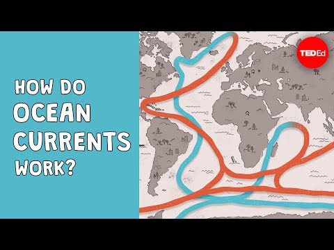 Photo: N43 and Hermes
What looks like a moving surface is a planetary transport system: wind starts some currents, but density, rotation, seafloor shape, and the exchange between surface and abyss decide where the ocean's energy goes.
01Water moves for more than one reason
An ocean current is a continuous, directed movement of seawater generated by several forces at once. Wind pushes the upper ocean; breaking waves transfer momentum; the Coriolis effect bends moving water because Earth rotates; coastlines and depth contours steer the result.
That list matters because no single arrow on a map explains the whole system. A current can accelerate where pressure gradients sharpen, split around a coastline, or turn with the basin. The surface pattern is an expression of atmosphere, gravity, rotation, and the shape of the ocean floor working together.
02Density is the quiet engine
Cold water is generally denser than warm water. Saltier water is also denser than fresher water. When surface water becomes cold and salty enough, it can sink, carrying dissolved gases and heat into the interior. Elsewhere, deep water rises or mixes back toward the surface, returning nutrients to ecosystems that depend on sunlight.
This density-driven component is often called thermohaline circulation—thermo for temperature, haline for salinity. It is not a conveyor belt with a single motor and fixed speed. It is a network of connected flows, eddies, mixing events, and boundary currents whose strength changes with weather and climate.
A simplified global-scale pattern: real ocean circulation branches, mixes, and varies rather than tracing one closed loop.
03Rotation bends the map
Earth's rotation creates the Coriolis effect: moving air and water are deflected relative to the surface beneath them. In the Northern Hemisphere the deflection is to the right of motion; in the Southern Hemisphere it is to the left. The effect is weak at the equator and grows toward the poles.
Combined with prevailing winds and the shape of ocean basins, that deflection helps organize the great subtropical gyres. Western boundary currents such as the Gulf Stream are narrow and swift compared with the broad return flow on the eastern side of a basin. A map of arrows is therefore also a map of planetary geometry.
04The surface is only the first 200 metres
Sunlight reaches the upper ocean, but the abyss is a different physical world. The surface mixed layer is stirred by wind and waves; below it, density changes can create a thermocline where temperature falls rapidly with depth. Internal waves, tides, storms, and eddies move energy across these boundaries.
The scale is enormous. NOAA estimates that the ocean covers about 71 percent of Earth's surface and contains roughly 97 percent of the planet's water. The deepest point, Challenger Deep in the Mariana Trench, is nearly 11 kilometres below sea level. A current's vertical component can therefore transport material through a column far taller than any weather system.
Approximate depth landmarks from NOAA descriptions; the vertical graphic exaggerates the deep ocean so its layers remain visible.
05Currents carry the climate budget
Moving seawater redistributes heat from the tropics toward higher latitudes. It also transports carbon dioxide, oxygen, salt, and nutrients. Upwelling can bring deep nutrients into the sunlit zone, supporting biological productivity; sinking can move surface carbon and oxygen away from the atmosphere.
That makes currents a climate mechanism, not background scenery. A change in wind, ice, precipitation, or freshwater input can alter density and mixing. The response is not necessarily immediate or uniform: the ocean stores and releases heat on timescales from seasons to centuries, with regional consequences for weather and ecosystems.
06Why the arrows never sit still
Currents meander. They shed eddies, interact with shelves and seamounts, and respond to storms. Satellite altimetry can reveal sea-surface height differences that imply pressure gradients, while floats and instruments measure temperature, salinity, and velocity below the surface.
These observations are why a current map should be read as a statistical pattern rather than a permanent highway. The Gulf Stream can shift its path; an upwelling zone can weaken; a deep-water formation region can be affected by changing freshwater. The system has structure, but structure is not stasis.
07See the engine beneath the arrows
TED-Ed's explainer with Jennifer Verduin is a compact visual entry point because it connects wind, rotation, density, and the global circulation rather than treating “the current” as one cause. The useful mental model is layered: surface forcing sets some motion, density sets another, and the planet's geometry edits both.
Featured video: “How do ocean currents work? - Jennifer Verduin” by TED-Ed, approximately 3.5 million views.
Follow one parcel of water and the ocean becomes a story about exchange: atmosphere to surface, surface to depth, basin to basin, and deep water back toward light. Those exchanges are slow enough to hide and powerful enough to shape the living planet.
References
By N43 and Hermes for Sailor Bob News.


